Forest fire risk mapping in the Chefchaouen-Ouazzane region (Morocco)
Authors
Fouad ASSALI, Mohamed ROUCHDI, Moulay Mohamed AJERAME, Mouanis LAHLOU, Hicham MHARZI ALAOUI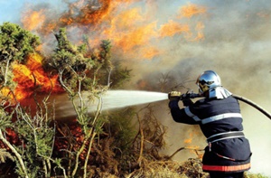
Key Information
Journal
Published in Vol. 4 No. 2 (2016) of Moroccan Journal of Agricultural and Veterinary Sciences.
Multidisciplinary journal that publishes original research articles and literature reviews in the fields of agriculture, agronomy, rural engineering, topography, forestry, horticulture, food, nutrition, animal husbandry and veterinary science (online-ISSN: 2550-4401, print-ISSN: 2028-991X). Indexed by DOAJ, Google Scholar, Articles DOAJ, Mirabelle, ROAD, WorldCat
About the Journal
Abstract
This study explores the possibility to predict the spatial distribution of forest fire ignitions in Chefchaouen-Ouazzane region (North-west of Morocco). The geographic information system was used to locate 613 forest fires recorded between 2002 and 2015. The building of dichotomous prediction model was developed based on the results of the binary logistic regression using 20 human and biophysical variables. A random sample of 2141 observations (60%) was used to build the model and 1427 external observations (40%) have been reserved for testing the ability of the model to predict forest fire ignitions. The explanatory variables included in the model, report on the impact of factors related to (1) human action represented by accessibility (roads and trails) and locations of great fires recurrences, (2) topo-climatic, including, the maximum daily temperature, relative air humidity and the slopes and (3) biological, namely the type of fuel, including firstly cork oak with a low density, and secondly the Matorral, the Lentiscus, the Erica, the Cistus and Kermes. The binary logistic model correctly classifies 88.1% of the sample reserved for the model building (2141 cases) and 86.9 % of validation data (validation test with 1427 observations). The map produced could operationally improve the alerts processes, the lookout posts positioning and the early intervention against fires by the units in charge of initial attacks. It should be emphasized that in this study ways of improvement are proposed in order to increase the accuracy of the forest fire ignitions probability map.
Keywords: GIS, Spatial modeling, Forest fire ignition, Predictive mapping, Logistic regression, Chefchaouen-Ouazzane
References
Details
License

Revue Marocaine des Sciences Agronomiques et Vétérinaires est mis à disposition selon les termes de la licence Creative Commons Attribution - Pas d’Utilisation Commerciale - Partage dans les Mêmes Conditions 4.0 International.
Fondé(e) sur une œuvre à www.agrimaroc.org.
Les autorisations au-delà du champ de cette licence peuvent être obtenues à www.agrimaroc.org.