Use of GIS and remote sensing data to characterize areas of high Desert Locust occurrence
Authors
Mohammed LAYELMAM, Mourad BOUZIANI, Mohammed Faouzi SMIEJ, El Hassane SEMLALI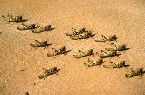
Key Information
Journal

Published in Vol. 5 No. 2 (2017) of Moroccan Journal of Agricultural and Veterinary Sciences.
Multidisciplinary journal that publishes original research articles and literature reviews in the fields of agriculture, agronomy, rural engineering, topography, forestry, horticulture, food, nutrition, animal husbandry and veterinary science (online-ISSN: 2550-4401, print-ISSN: 2028-991X). Indexed by DOAJ, Google Scholar, Articles DOAJ, Mirabelle, ROAD, WorldCat
About the Journal
Abstract
The Desert Locust is one of the most important species because it is very mobile and it covers large areas of invasion. It represents a major threat to agriculture in Morocco. Preventative control of these insects requires upstream monitoring to make effective interventions. Usually the prospectors evaluate the situation of locust directly on the site through the collection of information but this solution is very tedious for survey teams. The methodology adopted in this work is to use GIS and remote sensing data to: (1) Delimit high-frequency areas of locust signaling, (2) Generate occurrence maps by development (polymorphism) phase (Solitary, transient and gregarious), (3)Characterize the area of high occurrence of solitary locusts. The results of this work allow the survey teams to acquire information in the very large areas and characterize the favorable development place for the desert locust.
Keywords: Desert locust, GIS, Remote sensing, Morocco.
References
Details
License

Revue Marocaine des Sciences Agronomiques et Vétérinaires est mis à disposition selon les termes de la licence Creative Commons Attribution - Pas d’Utilisation Commerciale - Partage dans les Mêmes Conditions 4.0 International.
Fondé(e) sur une œuvre à www.agrimaroc.org.
Les autorisations au-delà du champ de cette licence peuvent être obtenues à www.agrimaroc.org.