Geospatial modeling of agricultural aid management under the Green Morocco Plan
Authors
Fatima Ezzahra ADOUS, Moha EL AYACHI, Mohammed Abdelwafi EL GHOUAT; Fatiha IBNNAIN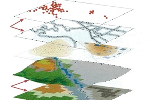
Key Information
Journal
Published in Vol. 5 No. 2 (2017) of Moroccan Journal of Agricultural and Veterinary Sciences.
Multidisciplinary journal that publishes original research articles and literature reviews in the fields of agriculture, agronomy, rural engineering, topography, forestry, horticulture, food, nutrition, animal husbandry and veterinary science (online-ISSN: 2550-4401, print-ISSN: 2028-991X). Indexed by DOAJ, Google Scholar, Articles DOAJ, Mirabelle, ROAD, WorldCat
About the Journal
Abstract
Within the Framework of the national agricultural strategy called Green Morocco Plan (PMV) launched by the Moroccan government, the funds are allocated by the Agricultural Development Fund (FDA) to encourage agricultural projects in all sectors. This study has the aim to design a geospatial conceptual model in order to study the distribution and the dynamics of the allocated funds. The results of the analysis will be a key resource for managing the agricultural lands. This has the goal to increase the opportunities of eligibility for applicants to the agricultural funds. The design of the new tool is carried out through several UML based diagrams for Unified Modeling Language as an object-oriented modeling language. This design will provide a complete view of the functional, static and dynamic aspects described respectively by the use case diagram, the sequence diagram and class diagram of the target system. Through this approach, policy makers will have a strategic key to trace the entire procedure, to Survey the behavior of the spatial component, to manage funding applications and to better manage allocated funds. The aim of this research is to present a new approach of the necessary paradigm of improving land information management related to the funded agricultural projects.
Keywords: FDA, geospatial, modelling, functional, dynamic, UML, land.
References
Details
License

Revue Marocaine des Sciences Agronomiques et Vétérinaires est mis à disposition selon les termes de la licence Creative Commons Attribution - Pas d’Utilisation Commerciale - Partage dans les Mêmes Conditions 4.0 International.
Fondé(e) sur une œuvre à www.agrimaroc.org.
Les autorisations au-delà du champ de cette licence peuvent être obtenues à www.agrimaroc.org.