Modeling erosion sensitivity by Medalus: Application to Bou Hayya watershed, Tunisia
Authors
O. BENJALLEB, R. HABOUBI, T. HERMASSI, H. BEN OUEZDOU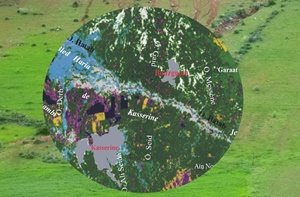
Key Information
Journal
Published in Vol. 9 No. 4 (2021) of Moroccan Journal of Agricultural and Veterinary Sciences.
Multidisciplinary journal that publishes original research articles and literature reviews in the fields of agriculture, agronomy, rural engineering, topography, forestry, horticulture, food, nutrition, animal husbandry and veterinary science (online-ISSN: 2550-4401, print-ISSN: 2028-991X). Indexed by DOAJ, Google Scholar, Articles DOAJ, Mirabelle, ROAD, WorldCat
About the Journal
Abstract
The watershed of Bou Hayya (406 km2) is located in the center oust of Tunisia. The river takes its source in the Massif of Bou Chebka - El My Abiod, where altitudes vary between 750 and 1312 m. Topography is contrasted and rainfall is intense and irregular, with an average of 300 mm/an. Vegetation cover is primarily steppe-like with a clear forest on the mountainous reliefs upstream. Alfa and Artemisia cover the piedmonts and the plains. This watershed is prone to an erosive dynamics that requires the identification of the most vulnerable zones in order to prioritize soil erosion control interventions. The mapping of soil sensitivity to erosion was carried out with the help of an index of sensitivity derived from the approach developed within the framework of MEDALUS project. The mapping of the sensitivity index showed that a good part of the watershed upstream and downstream is very sensitive to erosive by runoff. It also made it possible to identify the priority zones for soil conservation interventions.
Keywords: Water erosion, modeling, Medalus, Erosion sensitivity index
References
Details
License

Revue Marocaine des Sciences Agronomiques et Vétérinaires est mis à disposition selon les termes de la licence Creative Commons Attribution - Pas d’Utilisation Commerciale - Partage dans les Mêmes Conditions 4.0 International.
Fondé(e) sur une œuvre à www.agrimaroc.org.
Les autorisations au-delà du champ de cette licence peuvent être obtenues à www.agrimaroc.org.